
BOEING 737 MAX MODIFICATIONS (33)
AED installation


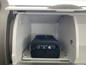
The use of automated external defibrillators (AED) is essential to increase the chances of survival in case of a cardiac arrythmias such as ventricular fibrillation (VF) and non-perfusing ventricular tachycardia (VT) when used in the first 10 minutes.
AMC1 CAT.IDE.A.220 (b) (4) stipulates that the aircraft operators should carry automated external defibrillator (AED) on board all aircraft equipped with a first-aid kit and required to carry at least one cabin crew.
B737 NG SBAS GNSS Aircraft Integration by Fokker Services


Overview
Fokker Services offers a certified solution for the integration of Satellite-Based Augmentation Systems (SBAS) and Global Navigation Satellite Systems (GNSS), supporting modern navigation, surveillance, and performance-based operations. This upgrade ensures compliance with global mandates while delivering operational efficiency and precision.
Full Y/C seats installation on B737-8 max delivered in 0 pax configuration


Contracted to develop a 189 Y/C pax on B737-8 MAX, PMV Engineering received the final EASA STC less than 5 months after the first discussions with the lessor.
IFE: Easy-to-install, cost effective bin divider with its restraint system


Prepared for portable IFE installation or any emergency equipement ?
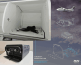
Keeping the max overhead bin space for the use of passenger is a challenge on every aircraft.
To optimize such precious space and to secure the IFE box, PMV Engineering has certified a easy-to-install, cost effective bin divider with its restraint system.
Certified DE-modification of Obsolete or Custom STC Installations


As part of lease return, phase-out, or aircraft transition processes, removal or reversal of previously installed STCs is often required. These could include obsolete systems, lessee-specific modifications, or customer-tailored configurations no longer applicable for the next operator.
Fokker Services provides certified engineering support for the full demodification process, ensuring compliance, traceability, and airworthiness restoration aligned with the requirements of the new lessee or owner.
Bose A30 Noise Cancelling Aviation Headset


The Bose A30 Noise Cancelling Aviation Headset (boomset) represent the next advancement in aviation comfort and safety. This headset introduces advanced noise cancellation technology, promising an improved in-flight experience.
Certified Turbonycoil Placard Installation


Fokker Services offers a minor modification to support the use of Turbonycoil oils (600 or 640) from Nyco (France) for your aircraft's engine, APU, or IDG systems.
Gogo Galileo LEO (Low Earth Orbit) Satcom system installation


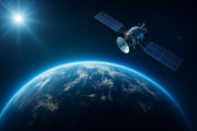
Gogo Galileo sets a new standard for global inflight connectivity, delivering high speed, low latency internet to every business aircraft, regardless of size or geography. Engineered exclusively for business aviation, Galileo redefines what's possible at 40,000 feet.
SpaceX Starlink for aviation - high speed internet in flight


Starlink provides high-speed, low-latency internet on tens of thousands of flights and counting, keeping passengers connected from the moment they step onboard their aircraft and througout their travels all around the world.
Fokker Services iPad® EFB modifications for Boeing aircraft


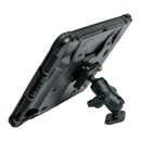
The EFB Solution for iPad® is a very interesting and cost effective way to introduce an installed classified EFB in your cockpit. An EFB is a physical device containing hardware and software that carries flight documentation. The EFB is used by the flight crew on the flight deck during their duties. Fokker Services’ EFB modification has already been installed in more than 1300 aircraft amongst different aircraft types. Our EFB installation is ticking all the boxes and is available for most aircraft types, including Airbus, Boeing, ATR, Bombardier Challenger & CRJ Family, Embraer, Fokker and others. We can support you with all hardware for your power supply (USB-A and USB-C) and iPad mount (adjustable and pivot mount), our product includes an Engineering Bulletin and all related supplements.


